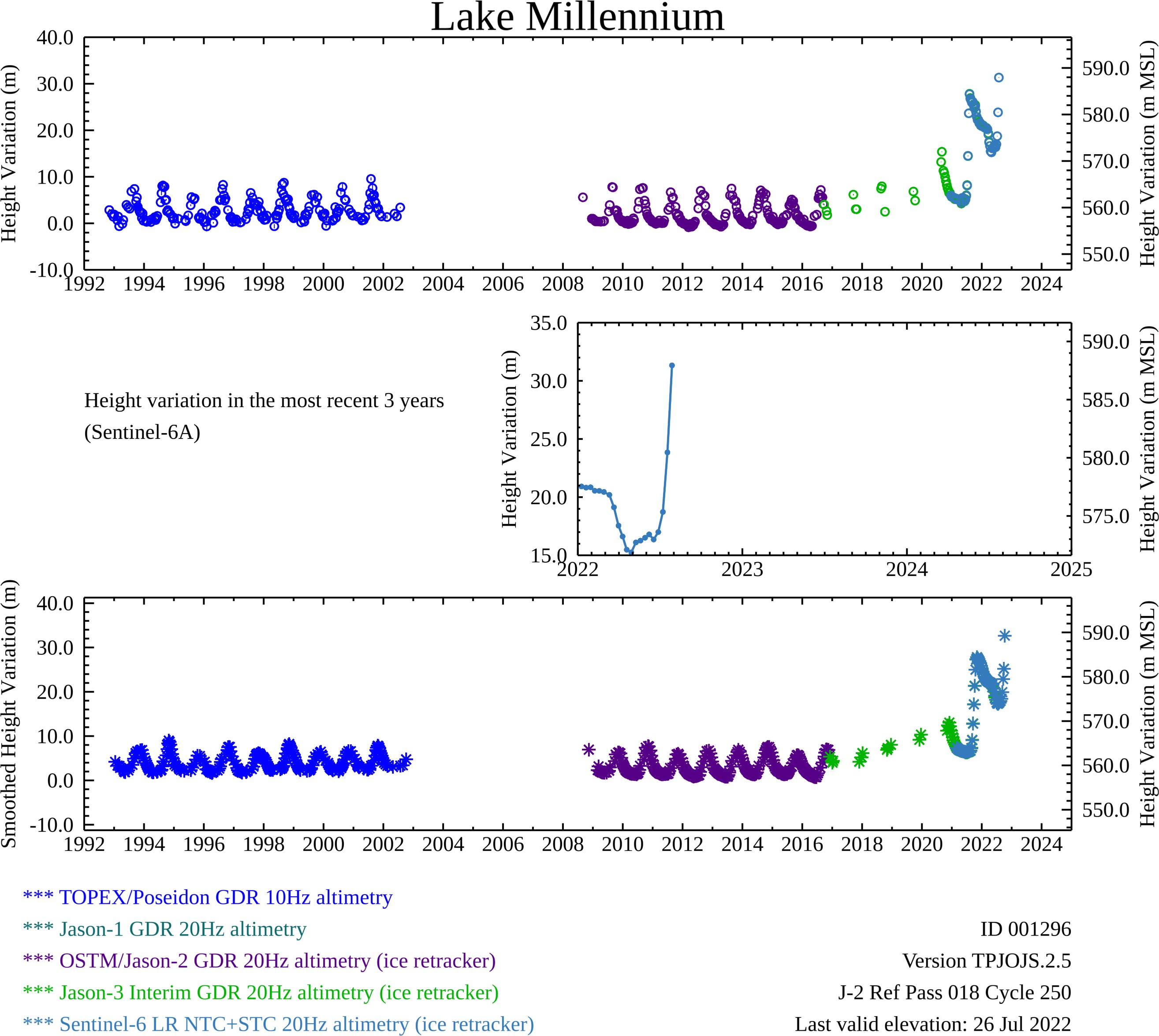
Long
Term
Status
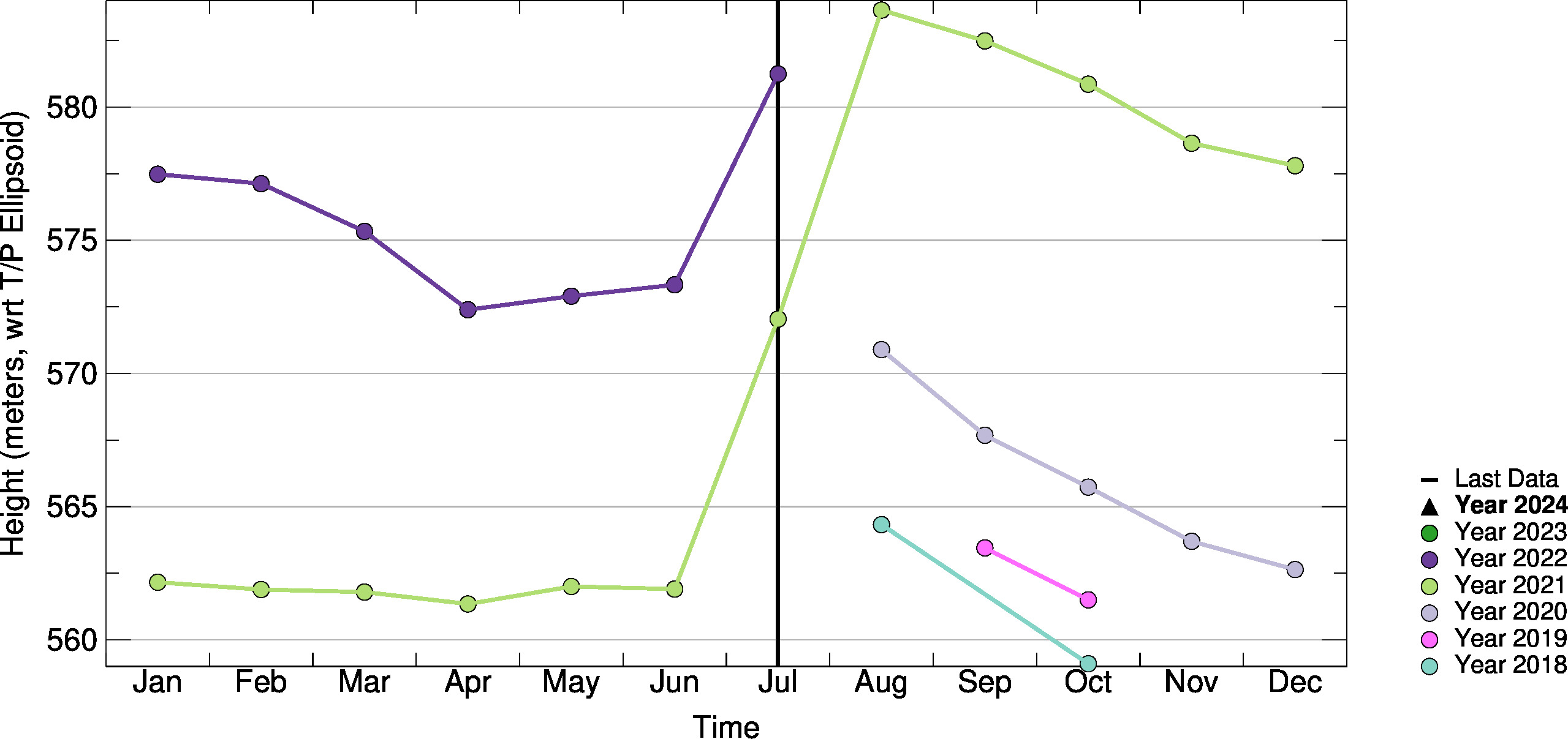
10-day
Monthly
Long term
Key:
Colors show that the current water level is within a set number of deviations from the mean baseline elevation.
The baselines are associated with the 10day, monthly, or long-term averages.
A white color or white symbol indicates the baseline could not be calculated.
Reservoir uses
HEP
Approximate Ice Month: N/A
Approximate reservoir formation year: 2019
Status Indicator Advisories:
Invalid Jason-2 datum period
Jason-3 era 2016-2022 compromised (J3/J2 merger)
10day-to-10day Comparison
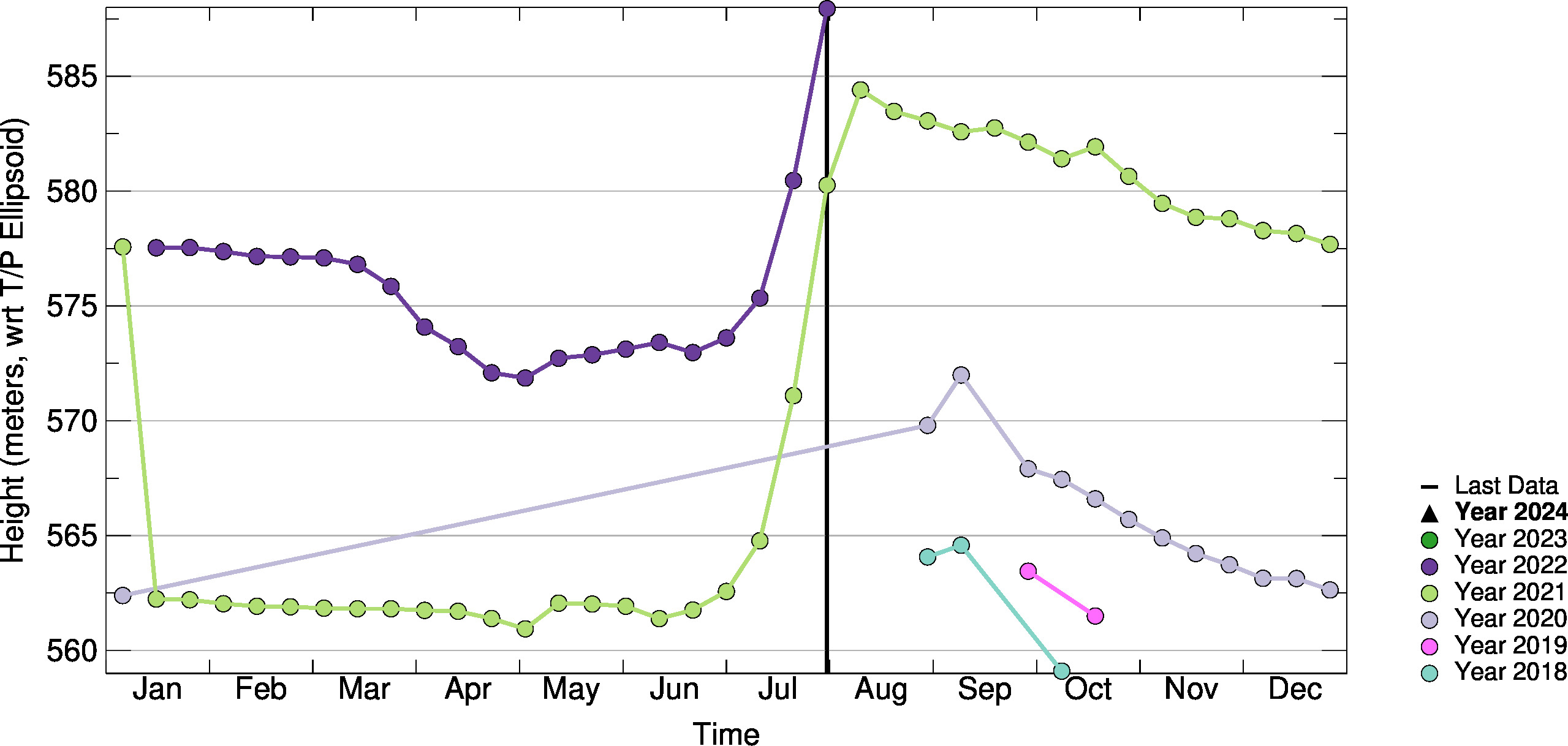
Month-to-Month Comparison
Relative Storage Variations
Relative Storage Variations Unavailable
Absolute Storage Variations
Absolute Storage Variations Unavailable
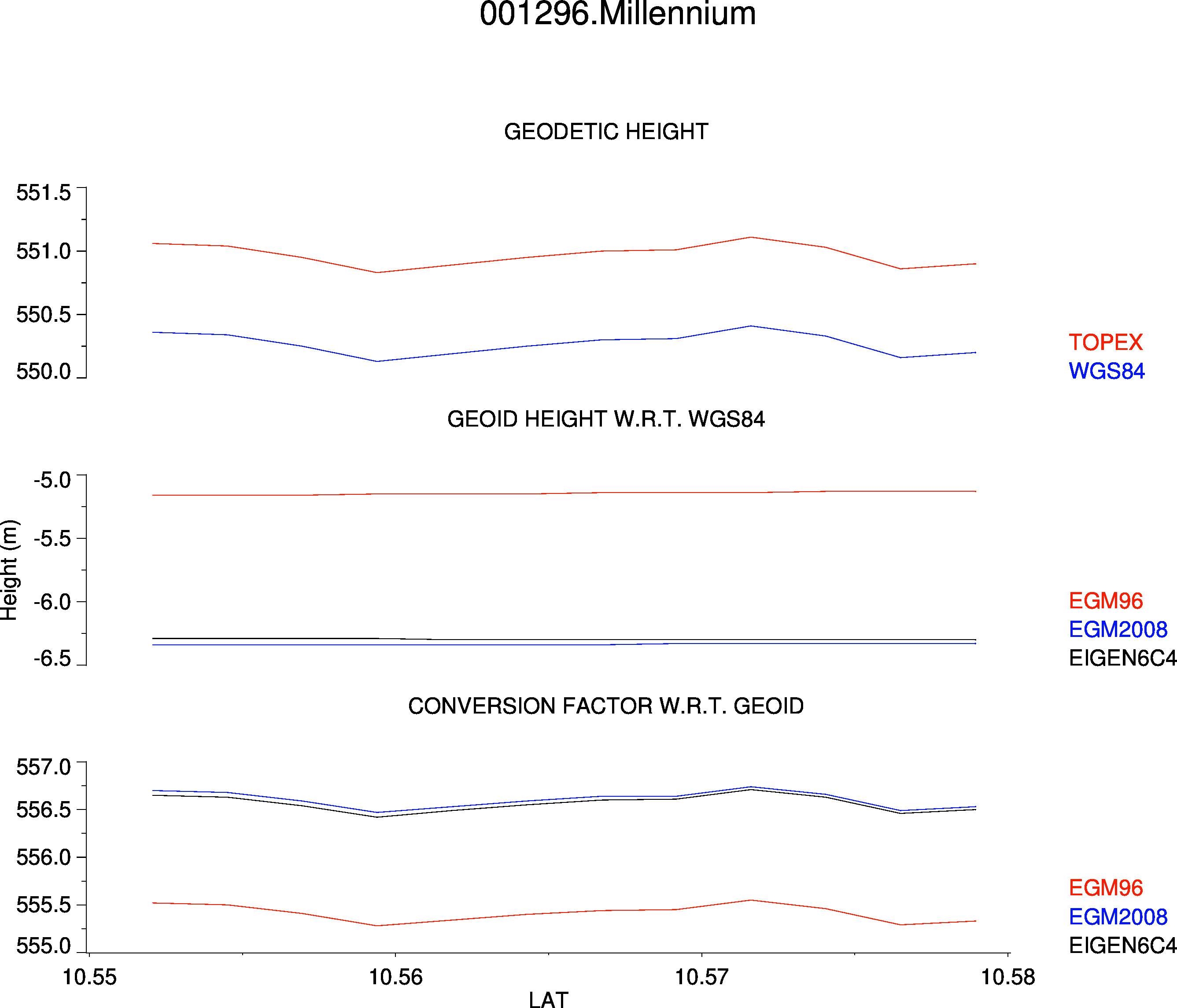
Components