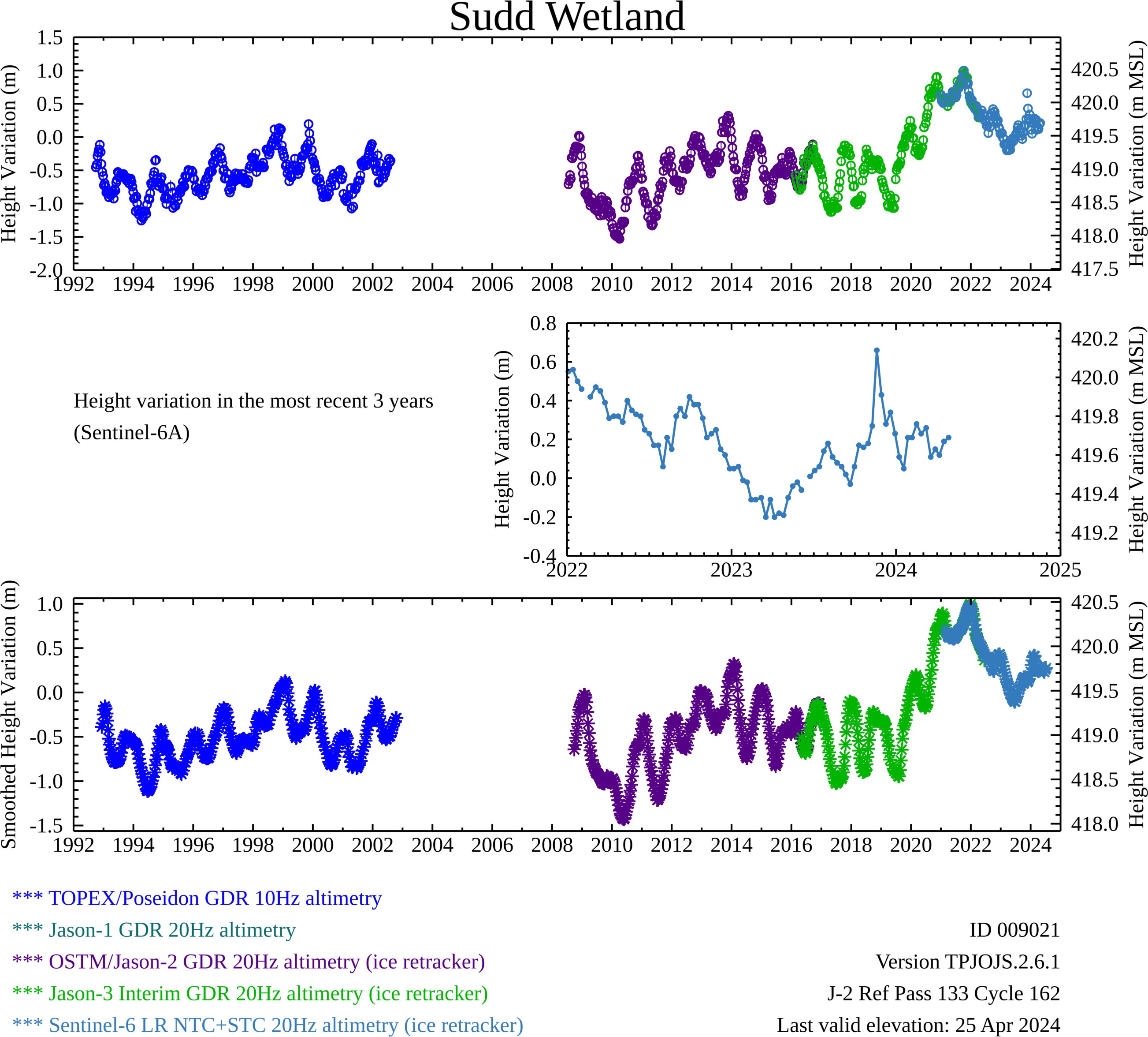
Shown above are relative lake height variations computed from the TOPEX/POSEIDON (T/P), Jason-1, Jason-2/OSTM, Jason-3, and Sentinel-6A Michael Freilich radar altimetry missions with respect to a datum that is based on a single fly-over date of the Jason-2/OSTM or Jason-3 mission. The equivalent water elevation with respect to mean sea level (msl based on WGS84/EGM2008) is also provided. Near real time observations are being provided by Sentinel-6A MF. The top graph are the processed results available for download. The bottom graph is a smoothed/filtered representation for general observation only. Open circle symbols in the top graph are potentially indicative of calm or frozen surface water. An additional square box highlights the typical freeze period based on general reports.