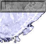
Arctic 2003
The Advanced Microwave Scanning Radiometer for EOS (AMSR-E) was successfully launched on NASA's EOS Aqua spacecraft on May 4, 2002. With the launch of this state-of-the-art radiometer, designed and built by NASDA of Japan, the sea ice research community will have available passive microwave sea ice products at a higher spatial resolution and a greater spectral range than previously possible. To make these sea ice products a useful research tool, a comprehensive AMSR-E sea ice validation program ( Arctic Validation Plan - PDF ) has been developed and is currently underway. An Arctic field campaign ( Arctic Field Campaign - PowerPoint ) with the NASA P3 aircraft was completed in March 2003 and an Antarctic campaign is scheduled for September 2003. The validation program consists of three main components: an aircraft/satellite/surface component, a satellite intercomparison component, and a modeling and algorithm sensitivity component.
AMSRIce03 Field Program
(external)
AMSR-E SEA ICE VALIDATION OBJECTIVES
- To establish retrieval accuracies based on statistical relationships between AMSR-E sea ice parameters and those same parameters derived from validation data sets covering as many geographical areas as possible for different seasons,
- To understand the limitations of each algorithm including the reasons for their particular level of performance in different regions and for different seasons,
- To suggest improvements to each of the algorithms based on the results of the validation studies.
AMSR-E SEA ICE VALIDATION PROGRM ELEMENTS
- Satellite/satellite data comparisons
- Coordinated satellite/aircraft/surface data comparisons
- Modeling and sensitivity analyses
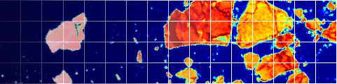
SATELLITE DATA COMPARISONS
- LANDSAT 7 ETM+
- EOS MODIS
- ADEOS II GLI & AMSR
- NOAA AVHRR
- DMSP SSMI & SSMIS
- RADARSAT & QUIKSAT
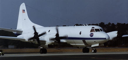
NASA WALLOPS P-3B INSTRUMENTATION FOR ARCTIC 2003
Sensor
Characteristics
Purpose
NOAA ETL Polarimetric Scanning Radiometer (PSR-A)
Operating Frequencies
(H&V-pol):10, 18, 22,37, 89 GHz
Simulate AMSR-E
Measurements.
NOAA ETL Polarimetric Scanning Radiometer (PSR-CX)
Operating Frequencies
(H&V-pol): 6 ,10 GHz
Simulate AMSR-E
Measurements.
NOAA ETL
IR radiometer and video camera bore-sighted with the PSR
9.6-11 um radiometer
Coincident surface temperature and
visible record of ice surface conditions
NASA Langley
Turbulent Air Motion Measurement System (TAMMS)
IR radiometer
Pressure ports coupled
with pressure transducers,
temperature sensors, and
water vapor instruments.
9.6-11 um radiometer
Measure turbulent heat and moisture fluxes over coastal polynyas
Surface temperature
NASA Wallops
Airborne Topographic Mapper (ATM-II)
Scanning Lidar altimeter
combined with a differ-ential GPS system
Maps ice surface topography at high resolution
NASA Wallops
Video and digital cameras
Tv video camera; 3 megapixel digital camera (KODAK)
Visible record of ice surface conditions
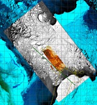
AREAS OF INTEREST
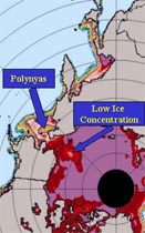
Sea Ice Concentration
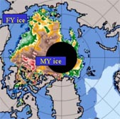
Multiyear Ice Concentration
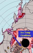
Sea Ice Temperature
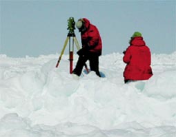
Coordinated NASA P-3, NSF Aerosonde and in-situ measurements (Barrow, AK area. Pilot effort - April 2002; Full campaign - Feb. - March 2003)
- snow depth and properties on sea ice
- sea ice and snowpack temperature
- ice type, thickness, roughness and microphysical properties
Modeling of the snow-ice-atmosphere column
- algorithm sensitivities and error under a range of conditions
- validation via forward modeling.
IGARSS 2004 poster
Cover of TGARS, Nov. 2006